
NWS: Chilling weather forecast includes significant ice, sleet, snow
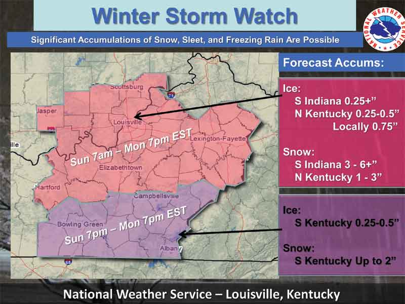
This National Weather Service map shows predicted ice and snow accumulations for the storm moving into Kentucky Sunday. Click the image to enlarge.
STAFF REPORT
Friday, Feb. 28, 2014, 5:05 p.m. — Central Kentucky can expect our existing Winter Storm Watch to be upgraded to a Winter Storm Warning.
Up to 3/4 of an inch of ice and 1 to 3 inches of snow are forecast for Central Kentucky beginning Sunday afternoon and tapering off by Monday evening.
In a conference call Friday afternoon, National Weather Service forecasters said that significant amounts of freezing rain, sleet, ice and snow are possible with this storm. Accompanying the storm will be steady winds expected to hit 25 to 30 miles an hour, with wind chills as low as 10 degrees below zero.
Stay tuned to local radio and TV for the latest changes in the forecast.
-30-


