
Saturday thunderstorms dump rain and hail, prompt tornado warning for county
NC GAZETTE / WBRT RADIO
STAFF REPORT
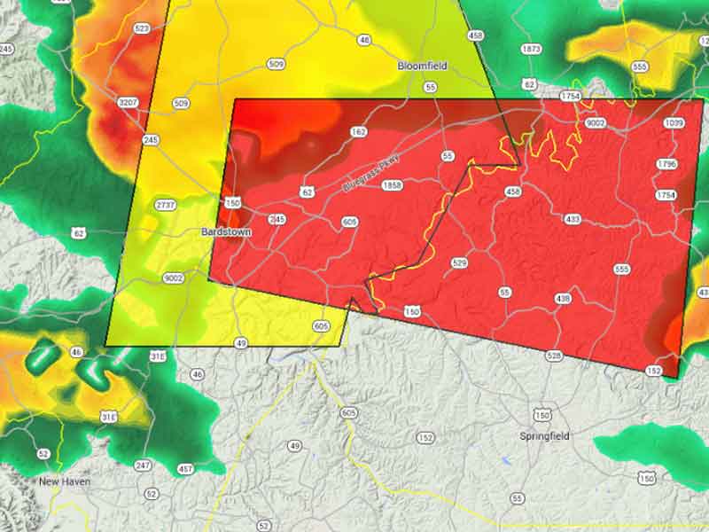
The area in red denotes the portion of Nelson and Washington counties that were under a Tornado Warning Saturday evening. The county remains under a Severe Thunderstorm Watch until 11 p.m. Saturday.
Saturday, April 25, 2015, 8:35 p.m. — The storms that passed through Nelson County Saturday evening prompted at least four Severe Thunderstorm Warnings and a single Tornado warning for central and eastern Nelson County. Reports of downed tree limbs followed the storms’ track through the county, with a tree reportedly down on East Halstead that took down some utility lines.
Along with wind gusts as high as 60 mph and heavy rain, the storms brought reports of significant hail. A weather spotter east of Nazareth reported 1 inch hail at 7:17 p.m. to the Louisville office of the National Weather Service. Another weather spotter reported 1-1/4 inch hail on Poplar Flat about 7:30 p.m.
At 8:28 p.m., National Weather Service radar showed a line of strong storms stretching from Hardin County to Paducah traveling to the east-southeast. Additional rain and a chance of a thunderstorm remain possible this evening and overnight.
For the fastest warnings on your smartphone or landline phone, please sign up for CodeRED, a free service offered locally by Nelson County Dispatch.

-30-


